|
Trashigang
- Thimphu: From east to west
|
 |
Bhutan's
Economy: Tourism |
|
 |
Bhutan Information |
|
|
 |
|
East-
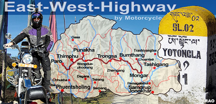
West- Highway: Crossing the Country
|

|
 Trashigang Trashigang |
It
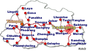
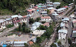
is five in the morning and dawn is breaking in the eastern horizon. Trashigang town, the largest urban centre in eastern Bhutan, is quiet and still
as the craggy hillsides that tower above it.
 |
| Some
elderly men and women with a bundle of belongings stand in the parking
as few young men load the bus with heavy sacks and bags. Other passengers
sip on hot suja and eat alu puri at the only restaurant open at the terminal.
The
bus conductor, a teenage lad, is sound asleep on the rear seat of the bus.
Some elderly men and women with a bundle of belongings stand in the parking
as few young men load the bus with heavy sacks and bags. |
|
A
few minutes later, he emerges with disheveled hair, a toothbrush in one
hand. The bus door is opened and people get in. Conductor Lepo grudgingly
helps Angay Dema find her seat; she cannot read.
Lepo
fastens the luggage on the bus with some strenuous pulling and knotting,
as driver Goembo climbs in. He lights a few incense sticks, pins them in
a hole in the dashboard and prays. The engine is started and it whirs for
a while. At exactly six am the 23 seater bus, Goembo Travels moves out
of Trashigang town, and makes the descend down to Chazam. The longest road
journey in Bhutan has begun.
Over
the next two days, the journey will cover 546 kilometres, through
sweltering hot mixed vegetation to the coldest alpine forests crossing
about five mountain passes or Laas in five dzongkhags before it reaches Thimphu.
Trashigang
Town
| Beyond
Sherichu, on the border between Mongar (Zhongar
dzong) and Trashigang the bus groans uphill towards Mongar. A few passengers in the back seat
stick their heads out and start throwing up. The first stop is Yadi, a
fertile paddy expanse in Mongar, about 45 kilometres from Trashigang, the
"breakfast" point.
The
driver and conductor are guided to an inner room for a free meal while
passengers choose between warm ba-thoue and momo. Few remain in the bus,
cracking open boiled eggs brought from home. |
|
 |
"Everyone
in," the conducter shouts and the journey resumes with the mood a little
more livelier as the driver plays the latest Rigsar Bhutanese songs on
his old worn out music system.
The
passengers are mostly elderly people going to Thimphu for treatment or to meet relatives. Some are civil servants on the way
to attend workshops, some are returning to Thimphu after a brief visit
home.
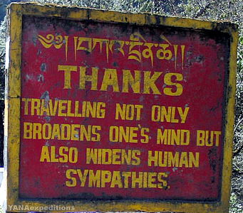 |
| "My
son asked me to come to treat my deteriorating eyesight," says Angay Dema.
"I also want to see my grandson," she adds. Next to her sits a teenage
boy, Tshering from Galing, Trashigang, who is going to work with his uncle
at Gayzamchu in Bumthang.
It is his first time on the bus and to Gayzamchu. "Don't forget
to tell me where to stop," the driver shouts to the boy over the drone
of the engine.
Tenzin
Dorji a private employee from Thimphu is returning from a visit to his village in Bartsham. "These visits are
expensive," he says."They expect a lot as a working person." Every now
and then the bus stops to pick prospective passengers and the half empty
bus when it started from Trashigang is now full. |
|
The
landslide hit stretches of the road still look risky with overhanging boulders
on the verge of sliding down. "On few occasions buses have been hit with
boulders and stranded for days at critical places like this," says Pema
in his late 50s, who claims to be a regular traveller to Thimphu. "I was
once stranded with no place to spend the night or eat."
 Mongar Mongar |
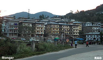
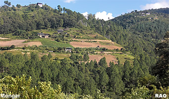
At
around 11:00 am the bus reaches Mongar (Zhongar
dzong), 90 kilometres from Trashigang. Lepo hurriedly wraps
a half-gho and runs off to register with the traffic police. "Take these
two people till Bumthang," it is a traffic police officer at the window
of the bus driver. "I cannot, I am full," the driver says pointing at the
occupied seats. The Road Safety inspector will be waiting on the highway,"
he adds and moves off leaving behind the traffic police officer, his relatives
and the others waiting for a lift.
It
gets warmer, almost hot, as the bus descends to Lingmithang. A faint
fragrance of the lemon grass wafts through the bus. Women are harvesting
lemon grass that grows wild on the hillsides. The lunch stop at Lingmithang is a welcome break. Passengers head for the bushes to relieve themselves.
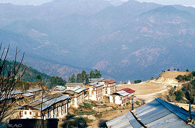 |
Mongar Town
A
road safety inspector gets in as the bus begins to ascend Thrumshingla.
He looks around with an air of authority and mentally makes a count of
the passengers. Not overloaded. The handy-boy and driver are unusually
polite to the inspector.
The
inspector stands near the door with the handy-boy as the bus climbs up
the treacherous 17 kilometre stretch to the highest pass in the country Thrumshingla at over 13,000 ft.
The
road is steep and narrow, rough, and full of potholes. In summer it is
covered in slush and in winter, passengers often have to push the bus through
knee-deep snow. |
|
Once
again the driver and conducter go into another room for a free lunch, as
the passengers queue up for white rice, pork, beef, and emadatsi that cost
from Nu.40 to Nu. 70 a meal. At the door is the owner, waiting to collect
the cost of meal. "Lopon you had pork ? It's Nu 70."
According
to the driver they always get free meals for bringing customers. "The owners
treat us with respect and it is a perk we drivers get," says Goembo. The
drivers also help to bring other necessities the eatery needs.
The
70-kilometre uphill climb from Lingmithang to Sengor is a weary
stretch. In the sweltering heat , the bus manages a speed of 10 kilometres
an hour. A signboard cautions 'drive slow accident prone area'. "These
buses are too old, and can break down anytime," says Tashi a civil servant.
"It's frustrating because you can't make it on time to attend meetings,"
he adds.
After
two hours of climbing, the bus reaches a foggy stretch known as Namling
brak (cliff). On this stretch, the road cuts through a rock face on
one side and a never ending perpendicular drop on the other side.
Namling
Brak is known as an accident prone site and a silence overtakes the passengers
as it crosses the grey narrow stretch. The last major accident in June
1998 claimed 58 lives. During the construction of the east west highway
Namling was the most difficult area. Old timers say that at one time 240
workers were buried alive in a mud slide during construction. The lateral
route finally opened in early 80s, 20 years after its construction started.
"In 1985 when I first ventured to Trashigang, passengers would all
get out of the bus and walk across the Namling stretch," said driver Goembo.
 Sengor Sengor |
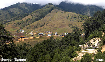
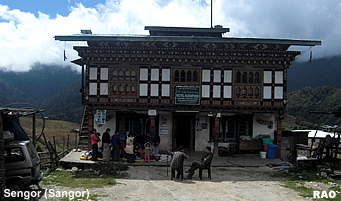
At
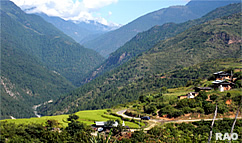
around 1:30 pm the bus stops at Sengor (Sangor). The almost plain valley
with few scattered houses looks barren except for potato and radish cultivation.
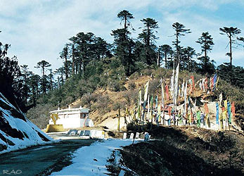 |
Thrumshingla Pass
A
road safety inspector gets in as the bus begins to ascend Thrumshingla.
He looks around with an air of authority and mentally makes a count of
the passengers. Not overloaded. The handy-boy and driver are unusually
polite to the inspector.
The
inspector stands near the door with the handy-boy as the bus climbs up
the treacherous 17 kilometre stretch to the highest pass in the country Thrumshingla at over 13,000 ft.
The
road is steep and narrow, rough, and full of potholes. In summer it is
covered in slush and in winter, passengers often have to push the bus through
knee-deep snow. |
|
At
the highest point, except for prayer flags and a coffee house that is always
closed, there is no other sign of human activity. As the bus goes over
the pass the passengers shout in unison "lha gyelo"
By
about 5 pm, the snaking descent from Gayzamchu gives way to the
gentle slopes of Ura. On
the left of the highway are groups of clustered traditional houses demarcated
by stone walls at the foot of the valley. People are still working on the
wheat and potato fields
 |
| Contributed
by Samten Wangchuk, Kuensel, Bhutan's National Newspaper, 2006 |
| Information on Bhutan |
 |
|


