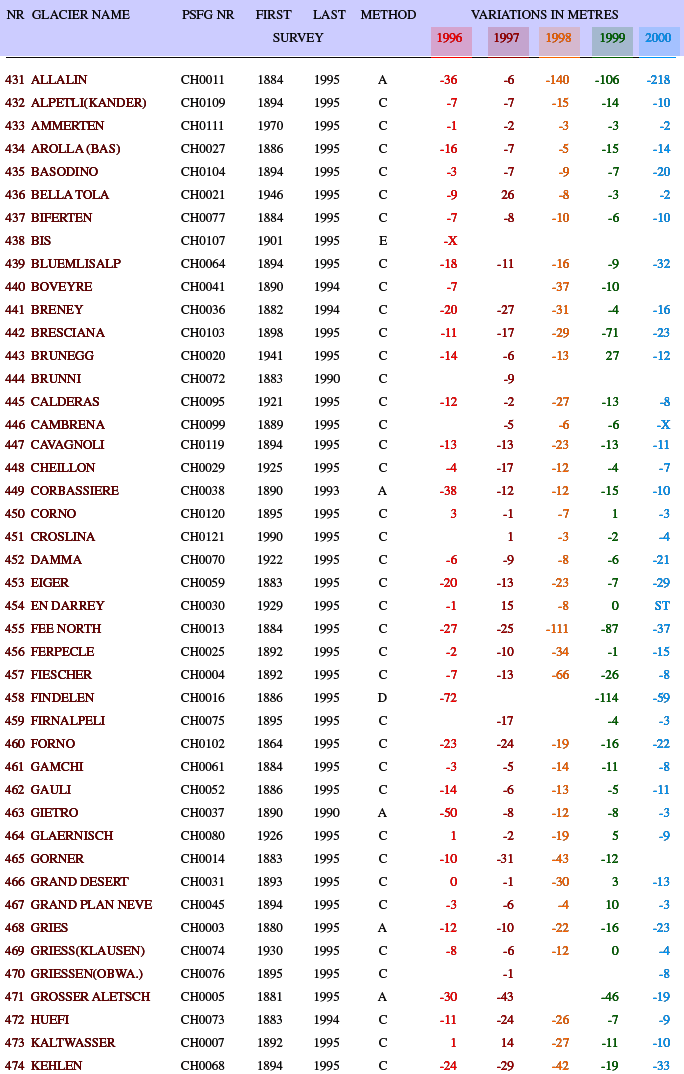
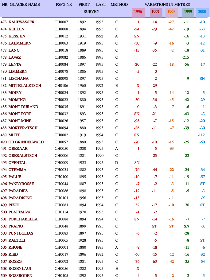
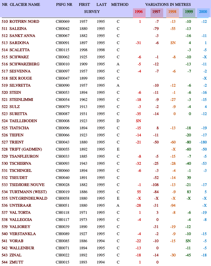
| NR |
Record
number |
| GLACIER
NAME |
15
alphabetic or numeric digits |
| PSFG
NUMBER |
5
digits identifying glacier with alphabetic prefix |
|
denoting
country |
| METHOD |
a
= aerial photogrammetry |
|
b
= terrestrial photogrammetry |
|
c
= geodetic ground survey |
|
(theodolite,
tape etc.) |
|
d
= combination of a, b or c |
|
e
= other methods or no information |
| 1ST
SURVEY |
Year
when first front variation data is available (at |
|
WGMS) |
| LAST
SURVEY |
Last
survey before reported period |
| VARIATION
IN METRES |
Variation
in the position of the glacier front in horizontal |
|
projection
expressed as the change in length between |
|
the
surveys |
| Key
to Symbols |
+X
: Glacier in advance |
|
X
: Glacier in retreat |
|
ST
: Glacier stationary |
|
SN
: Glacier front covered by snow |


