Nepal Trekkings
Trekkings in Nepal
Trekking Programmes
previous page
end Nepal Trekkings HOME
Grafik Nepal Trekkings
Panchase-Ramche Danda Trekking Information
Ramche Danda Trekking in Brief - in Kürze
Ramche Danda Trekking Rating - Bewertung
Pokhara Center of tourism
Trekkings: Programmes - Info
Trekking Areas
about the Himalayas
Grafik
Ramche Danda - Panchase Trekking
Grafik
Trekking Information
Grafik
Ramche Danda and Panchase Danda Trekking (around Phewa Lake)
Grafik
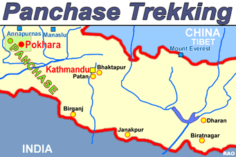
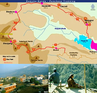
Panchase - Ramche Danda Trekking area Panchase - Ramche Danda Trekking map
Area Panchase map
Click on the map to get an enlarged picture.
Grafik
Panchase information

top

Summary
Ramche Danda and Panchase Danda Trekking (around Phewa Lake)
4 or 5 days
start of trekking
Beginn
Pokhara
end of trekking
Ende
Pokhara
transports
Transporte
Pokhara e.g.
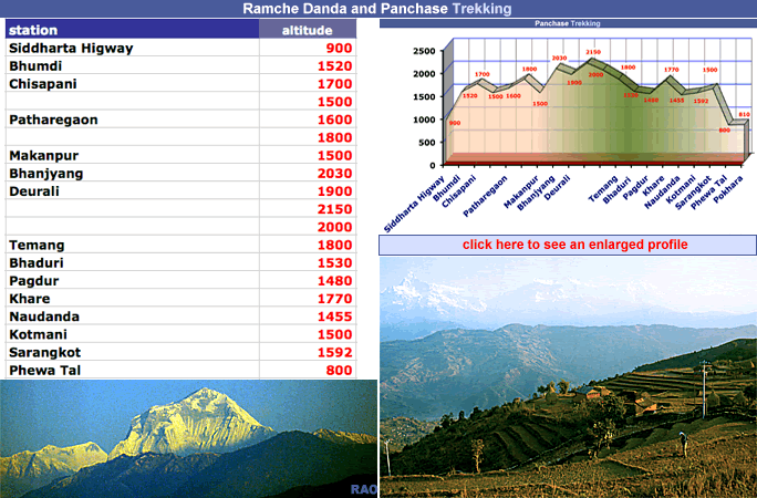
lowest point
tiefster Punkt
Pokhara 800 m a.s.
highest point
höchster Punkt
Aaleauchki Danda 2000 m a.s.
checkposts
Kontrollposten
no
lodging
Unterkünfte
Pokhara, Bhanjyang, Bhadaure, Naudanda, Deurali, Raniswara, Sarangkot
and more possibilities
food
Nahrung
Pokhara, Bhadaure, Naudanda
and more possibilities
camp grounds
Zeltplätze
Bhumdi, Bhanjyang, Bhadaure, Sarangkot, Pokhara
river crossings
Flussüberquerungen
only small rivers, no problems
places of interest
Sehenswürdigkeiten
-
monasteries
Klöster
on the trek: we haven't seen any gompa
view points
Aussichtspunkte
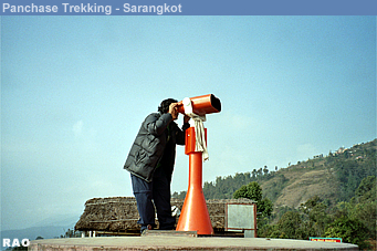
there are a lot of view points.
Bhumdi, Bhanjyang, Deurali, Sarangkot
maps
Karten
POKHARA Town & Valley
Tourist Map / Touristenkarte
Scale Valley 1: 50,000 / town 1:20,000/
lake side 1:9,000
Karto Atelier
www.karto-atelier.com
Swiss made

AROUND ANNAPURNA
Scale 1:125,000
HIMALAYA-KARTOGRAFISCHES INSTITUT

Day 1 Pokhara - Siddharta highway (by bus)
bus stop to Bhumdi
Day 2 Bhumdi - Bhanjyang
Day 3 Bhanyjang - Deurali
Day 4 Deurali - Sarangkot (or Pokhara)
Day 5 Sarangkot - Pokhara

Very useful maps
( but: should be printed on better paper)
Order: www.karto-atelier.com
You can buy these maps in Nepal too.

Nepal map Pokhara map

top

Rating
Beauty
Schönheit
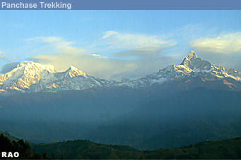
beautiful view to the Himalayas
(from the Dhaulagiri Group to the Ganesh Himal)

fantastic
Trekking Grade
Anforderungen
rough: Ramche Danda area
steep: Sarangkot - Pokhara (down)
Grade 2
moderate
Culture
Kultur
Grafik
Facilities
Unterkunft, Verpflegung
there are lot of lodges, especially on the Sarangkot route
good
Altitude
Höhenlage
between 800 m and 2000 m above sea level Grade 1
Trekking grade
Grade 1
easy
Grade 2
not too hard
Grade 3
sometimes
strenuous

strenuous
Grafik
Grafik
Gallery

more information and pictures
Weather in Nepal Nepal Maps
Nepal Trekkings: Trekking Profiles Trekking Programmes
Nepal Kalinchowk - Khumbu
Glaciers in Nepal Photo Gallery
Himalayas & Tibet
Langtang - Gosainkund Everest Region
Bhutan Flight over the Himalayas
Nepal Himalayas: Air view
Tibetan Plateau and the Himalayas
Himalayas in Nepal: Mountain Peaks
Annapurna Region
Grafik
Grafik
Weather in Nepal Nepal Maps
Grafik
Grafik
previous page Nepal Trekkings HOME