 |
Nepal Trekkings |
|
 |
Nepal Information |
|
|

|

|
Upper
Mustang is the restricted northern part of Nepal's Mustang District which
consists of seven Village Development Committees VDC (Nepal's smallest
democratic units) with 31 settlements. The restricted area includes the
historic kingdom of Lo Tsho Dhun, which translates as 'seven districts
of Lo' in the local Tibetan dialect. Tibetan dialects prevail here too.
And the ancient walled city of Lo Manthang is the most isolated and unexplored
corner of the Himalayas. About 1,100 Lobas (people of Lo), live in the 180
mud houses of the walled city and they observe a form of caste hierarchy.
 |
Being
a kingdom within a kingdom
Mustang is currently ruled by the 25th descendent
of the founder of the Kingdom of Lo who has married a member of aristocratic
family of Lhasa. The King's duties are largely ceremonial. He is respected
by the people and consulted about many issues by villagers throughout Lo.
|
The
'Lo' is derived from 'Lho" meaning south open and border of Tibet. The
largest settlement in this area is Lo Manthang, a small fort city with
20 feet high surrounding walls, sentinel turrets at each corner and prayer
flags blowing in the wind.
Entry
Point
Bhansar actually is a symbolic entry point into Nepal. A well built but emptied
customs office indicates the beginning of the Nepalis territory which is
actually around 7 km from the real border. There is no one manning this
Bhansar customs post and Tibetan KhaMaps use the huge ground behind it
to establish their tinted shops filled with daily goodies, including cheap
Chinese beer, wine, alcohol, torchlight, thermos-flasks, shoes, jackets,
well decorated hand carved Tibetan furniture. People in the area choose
the goods that they want first and Khampa traders come later and fix the
price of each item at their will.
The
casualty of the Chinese trade is not only the Nepalis economy but also
the Nepalis environment of the Himalayan region. The one thing that one
notices on reaching Lo Manthang is broken glasses, tin cans and plastic
packs of biscuits and noodles flying here and there.
Dry
region
The
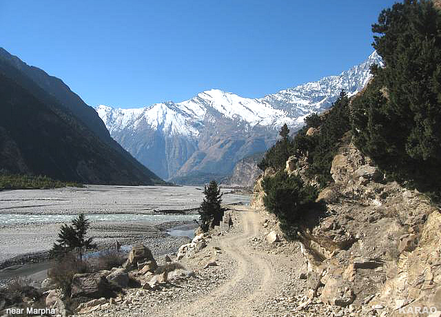
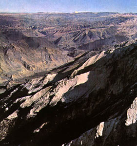
Mustang region is dry, desolate and windy, and is a paradise like no other
on earth. Strong winds blowing up between the Annapurna and Dhaulagiri
mountains have created a dry desert landscape- dusty and bare in all its
beauty. Because of dry climate found over here agriculture is impossible
without irrigation and agro-productive land is also very nominal. Polyandry,
marriage of one woman with two or more brothers, is still in practice to
avoid the splitting of the family's farmland. But like all traditional
ways, these are changing too.
Salt
trade -Route
Of
the existing twelve major trade routes or passes in the Himalayan region
along the Nepal-Tibet border, four passes are located in Mustang leading
to Kaligandaki river. The ancient 'Salt trade route' was created along
the Kaligandaki river. The Tibetan traders carried salt from the salt lakes
of Tibet border, and the Lobas (people of Lo) further carried it to Thak
khola in Tukuche on mules covering a five-day trail and carried food grain
and domestic goods back home on the return journey. Until recent times,
the trade in salt of Tibet, has not only sustained the people in the poor
and barren lands of Nepal and Tibet, but has also set in motion an institutionalized
relationship.
top
Lo
Manthang: The face is changing
The
face of Lo Manthang is gradually changing. The dirt road extended from
Tibet passing through Nechung to the medieval settlement of Lo Manthang
was completed some months ago. It has started to show its impact not only
on the local economy but also on the local environment and community as
a whole. One major visible impact that Lo Manthang would have from
the road and increase in the traffic is already underway. Lo Manthang is
known as a medieval walled city. The mud and stone wall surrounding the
tiny settlement of around 180 houses and 900 people will crumble with the
increase in vibration caused by the traffic. A portion of the mud wall
has already fallen which needs immediate repair.
People
at Lo Manthang seem very happy that they have now road access to China
and that their daily necessities could be supplied from China, if not from
their own country. Their dependence on Khampa traders and Chinese goods
is increasing day by day as they are being introduced to consumerism and
new products. However, the trucks and vehicles coming to Lo Manthang will
create serious question on its identity that is why we have suggested not
to bring the trucks and other vehicles within Lo Manthang city.
Highlights
The
Upper Mustang was opened as a restricted area since then only 1000 foreigners
are permitted annually for tourists in 1990.
 |
Land
of Lo Manthang, the isolated Kingdom of Upper Mustang. |
 |
Fascinating
medieval villages, monasteries and fortresses. |
 |
Eroded
ridges, wind swept terraces, summer fields of barley, wheat and millet. |
 |
Richly
colored upland desert and mountain scenery. |
 |
Former
major caravan route between India and Tibet. |
|
more information on Nepal
|
 |
|


