|
Nepal's
Nature |
|
Earthquakes |
|
|
Nepal's
Nature |
|
Earthquakes |
|
|
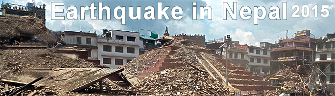
Destruction from the earthquake |
|
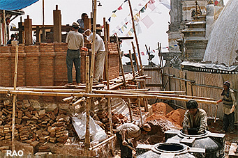
Reconstruction |
|
|
|
Near the earthquake's epicenter |
|
Photo Galleries |
|
|
Near the earthquake's epicenter |
|
Photo Galleries |
|

|
|
 |
|
| April 2015 |
| A M 7.8 earthquake struck Nepal |
|
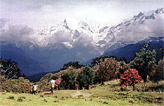 |
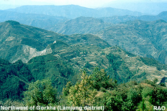
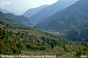
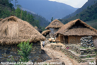
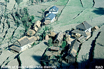
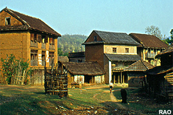
| Lamjung Himal near Taprang Kharga |
| A
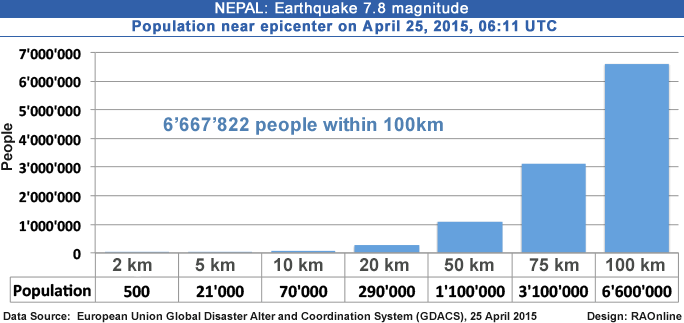
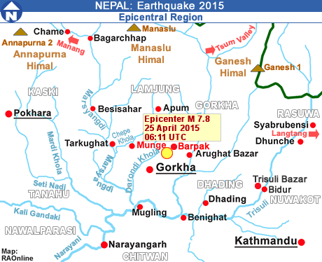
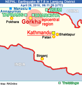
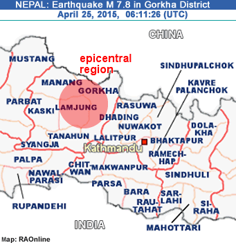
massive earthquake of 7.8 magnitude has rocked central Nepal, causing extensive damage to buildings and hundreds of death and injuries. The quake struck an area in Lamjung District between the capital Kathmandu and the city of Pokhara.
The epicenter was located 77km (48mi) Northwest of Kathmandu 73km (45mi) East of Pokhara. |
|
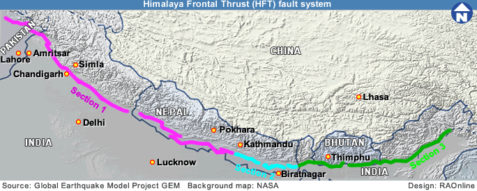
The earthquake occurred as the result of thrust faulting on or near the main frontal thrust between the subducting India plate and the overriding Eurasia plate to the north.
 |
A M 5.3 earthquake on April 21, 2015, in the same area caused no major damages and no fatalities.
The M 7.8 quake is worst to hit Nepal in 80 years. Nepal authorities say that more than 1,000 people have been killed. More than 500 people have been killed in Kathmandu alone. The historic Dhahara tower collapsed with at least 50 people trapped within the building. Temporary medical centers have been set up in the capital city. |
|
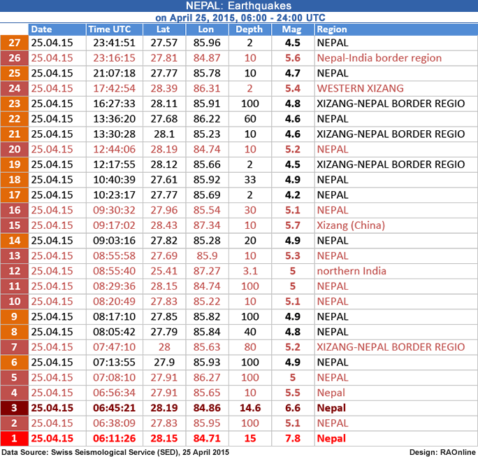
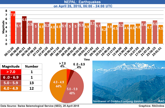
About 20 aftershocks have been recorded until noon. The tremors have been felt in Northern India, Pakistan and Bangladesh.
Buildings and walls across Kathmandu have collapsed although it is hard to tell how serious and extensive the damage is. Tremors were also reported to have sparked avalanches in the Himalayas, including on Mount Everest.
 |
Earthquake Details
provided by Swiss Seismological Service (SED) (ETH Zurich Switzerland) |
25 Apr 2015
06:11:26 UTC
M 7.8
Depth: 15 km |
25 Apr 2015
06:45:21 UTC
M 6.6
Depth: 14.6 km
|
25 Apr 2015
06:56:34 UTC
M 5.5
Depth: 10 km |
25 Apr 2015
12:44:06 UTC
M 5.2
Depth: 10 km |
25 Apr 2015 08:20:49 UTC
M 5.1
Depth: 10 km |
|
 |
| Earthquake Details |
provided by United States Geological Survey (USGS) |
| Magnitude |
7.8 |
| Date-Time |
25 Apr 2015 06:11:26 UTC |
| Location |
28.147°N, 84.708°E |
| Depth |
15 km set by location program |
| Region |
NEPAL Lamjung |
| Distances |
34km (21mi) ESE of Lamjung, Nepal
58km (36mi) NNE of Bharatpur, Nepal
73km (45mi) E of Pokhara, Nepal
76km (47mi) NW of Kirtipur, Nepal
77km (48mi) NW of Kathmandu, Nepal |
|
The last major earthquake to strike Nepal was in 1934 which had a magnitude of 8.3 Richter. It caused great loss of life and considerable damage to buildings. Since then, the population of the country has skyrocketed along with urban development.
 |
| One, a M 6.9 earthquake in August 1988, 240 km to the southeast of the April 25 event, caused close to 1500 fatalities.
The largest, an M 8.4 event known as the 1934 Nepal-Bihar earthquake, occurred in a similar location to the 1988 event. It severely damaged Kathmandu, and is thought to have caused around 10,600 fatalities. The M 8.4 quake claimed more than 8,000 lives and levelled around 70 percent of the buildings in the Kathmandu Valley. |
|
Study: About 50 million people live in Nepal at risk of a massive earthquake
 |
A massive earthquake of eight or more magnitude will probably occur along the edge of the Himalayan mountains in the near future, putting more than 50 million people at risk and threatening large cities in India, Nepal, Pakistan, Bangladesh and Bhutan, researchers of the University of Colorado, Boulder (U.S.A), said.
In a study , researchers say that at least one earthquake of 8.1 to 8.3 magnitude is overdue along the 2010-kilometer (1250 miles) seismically active front of the Himalayan mountains. |
| Massiv earthquake to be expected |
|
|
| Source: USGS National Earthquake Information Center (NEIC), 25 April 2015 |
|
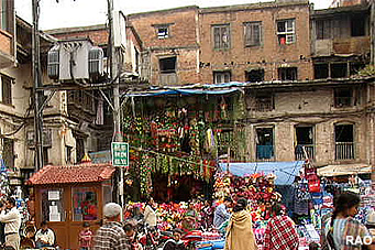
| Nepal Trekkings in the Gorkha Region |
|
Nepal |
|
Links
|
|
 |
|
External
Links |
|