| Bhutan's
glaciers and glacial lakes |
 |
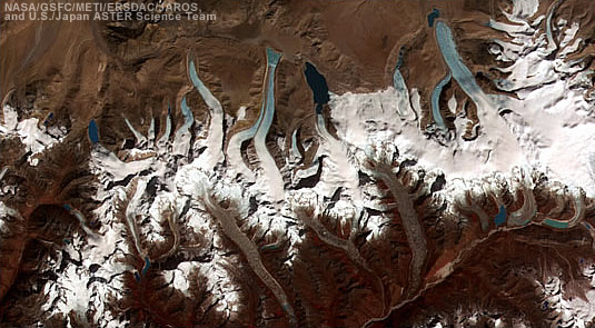
Bhutan Glaciers - Glacial Lakes |
|
 |
Bhutan Glaciers - Glacial Lakes |
|
|
 |
|
United
Nations' Support
|
|
Glacial
Lake Outburst Floods (GLOF) |
 |
 |
 |
Glacial
Lake Outburst Floods (GLOF) is one of the biggest hazards the country will
continue to face given its numerous rivers which are glacial fed. |
 |
Natural
disasters such as GLOF take tremendous toll on development often negating
development efforts and threatening prospects of achieving the Millennium
Development Goals (MDGs). |
 |
UNDP
helps the Government strengthen national capacity to address these challenges
relating to climate change. This has been carried out through the Greenhouse
Gas Project which began in 1996 and the National Programme of Action for
Adaptation to Climate Change (NAPA), which concluded recently. |
 |
NAPA
is a process initiated in the Least Developed Countries (LDCs) to identify
urgent and immediate projects and activities that can help communities
adapt to the adverse effects of climate change. |
 |
Taking
into consideration all the different dimensions of climate vulnerability,
the NAPA process in Bhutan recommended a national disaster risk management
framework as a top priority. |
 |
The
Government with support from the UNDP in partnership with other resident
UN agencies have developed a National Disaster Management Framework in
2006. |
 |
Another
urgent need for the Government is to reduce the water levels of the potentially
high risk glacial lakes, namely theThorthormi(Thortomi) and Raphstreng
lakes, to mitigate the immediate threat posed by these lakes outburst to
the population residing in the Punakha-Wangdi and Chamkar valleys in central
Bhutan. The worst case scenario, according to some studies predicts the
collapse of the wall separating the two glacial lakes as early as 2010,
which could result in huge devastation downstream. |
 |
UNDP
with funds from the Global Environment Facility (GEF) is helping the Government
develop the capacity of the Government and the local communities to adapt
to the vulnerabilities related to climate change. This will include assessing
the most suitable early warning systems for GLOF threat in the Punakha-Wangdi
valley, the implementation of hazard zonation and vulnerability mapping
for the valleys including capacity building for climate change-induced
disaster risk management at the national, intermediate and local levels.
An Inception workshop was held with all stakeholders on 25 January in Punakha
to take forward the project. |
top
|
UNDP helps Bhutan to reduce risks of massive glacier lake flooding
|
 |
Rising temperatures as a result of climate change are melting Bhutan's immense collection of glaciers in its mountainous north, threatening significant human and economic devastation. In response, UNDP is working with the Government on a project to reduce the damage caused by flooding in the country's highly populated south, where glacier lakes grow at alarming rates.
"Glaciers in the Himalaya are melting faster than in other parts of the world," said Gernot Laganda, a UNDP climate change advisor who is providing support to the project. "Runoff begins to accumulate in unstable lakes on the glaciers, and when these lakes become too heavy, their natural barriers burst. The result is a mountain tsunami that destroys everything in its path downstream."
While the effects of climate change may still feel theoretical in some countries, they have become all too real in Bhutan, where glaciers are now melting at a rate of almost 30 to 60 meters a decade. The majority of people practice subsistence farming on tiny plots of land that are extremely vulnerable to flooding.
In addition, 45 percent of the country's revenue comes from the export of hydropower to neighboring India, a national industry that could be irretrievably affected by glacial retreat.
"When it comes to climate change, the rapid growth of glacier lakes is only the first in a range of problems for Bhutan," Laganda explained. "Over the long term, glacier melt will reduce river flows in periods of low rainfall, which will have immense effects on hydropower production. This could become a devastating blow to the very backbone of the nation's economy."
UNDP's project is targeting Bhutan's two most vulnerable areas, the Punakha-Wangdi and Chamkhar valleys, home to 10 percent of the country's population and important infrastructure.
Experts have identified 25 potentially dangerous glacier lakes in Bhutan and paint a worst-case scenario of massive flooding, a so-called ‘Glacier Lake Outburst Flood', down the Punakha-Wangdi valley as early as 2010. If a comprehensive disaster risk management system is not established soon, the impact of glacial lake overflow will be severe.
"Countries cannot afford to only discuss IPCC scenarios and temperature curves until something finally hits them," Laganda said, referring to the UN's Intergovernmental Panel on Climate Change, a scientific body tasked to evaluate the risks of climate change caused by human activity. "We all have to start getting our hands dirty."
Supporting the Government of Bhutan to access financing from the United Nations Framework Convention on Climate Change, Least Developed Countries Fund and the Austrian Government, UNDP is working with a range of Departments to establish an early warning system for glacier lake outburst floods, strengthen disaster risk management plans, and improve the preparedness of local communities who are threatened by glacier lake flooding.
In an unprecedented effort, a project has been launched to lower the water level of Lake Thorthormi, a glacial lake that is ranked as one of the most dangerous in the country. Such a controlled drainage effort requires detailed geographical and geological surveys, an evacuation plan in case the lake collapses, a sound engineering plan and an exhaustive system of training and evaluation. Once completed, the project will provide valuable experiences to countries confronted with similar problems, such as China, Nepal, Pakistan, India and Chile.
"The logistical difficulties of draining a remote glacier lake in a controlled manner are mind-boggling," Laganda explained. "Every shovel needs to be carried manually for two weeks up to a project site that lies more than 4,000 meters above sea level, and the window of good weather conditions is only open for three months per year."
"It sometimes seems like a Sisyphus-task," he continued. "But it is really a great example of a country taking charge and tackling the greatest challenge of our time head-on."
| Source:
UNDP Bhutan - United Nations Development Programme,
2009 |
 |
 |
 |
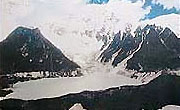 |
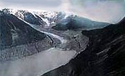
| Luggye
Lake |
Luggye
Glacier |
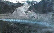
Raphstreng
Tsho |
top
| Information on Bhutan |
 |
| Bhutan and Nepal
|
 |
 |
| Source: United Nations Disaster Management Team, 2005 |
|
Links
|
 |
 |
 |
External
Links |
 |
 |
 |
 |
 |
| GRID-Arendal
News |
NASA's
Global Change Master Directory |
United
Nations Environment Programme |
World
Glacier Monitoring Service |
International
Centre for Integrated Mountain Development |
|
 |
 |
 |
|
|


