|
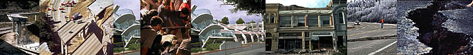
Bhutan Earthquakes |
|
|
Bhutan Earthquakes |
|
|
 |
|
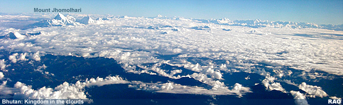
Bhutan
need not worry about a major earthquake disaster
|
 |
 |
| Bhutan,
said Dr. Motegi, had not experienced a major earthquake for centuries and
the likelihood that it would do so was minimal.
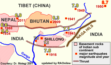
Dr. Motegi's
own study showed that the seismic active zone has shiftedto about 180
kilometers from the Himalayan foothills to the Shillong plateau which is
now the new boundary between the Asian and the Indian sub-continent plates.
"This means Bhutan is getting safer," he said. |
|
Roger
Bilham of the University of Colarado, leadauthor of the report, had concluded
in his study that an earthquake of 8.1 to 8.3 magnitude would strike
the 2000 kilometers seismically active front of the Himalayas "very
soon" to relieve the seismic strain that has been building up along the
contact points of the shifting Asian and Indian-sub continent plates, and
also because "no" suche earthquakes had hit the area in about 500 years.
In
an interview Dr. Motegi pointed out that, during the last 104 years,
earthquakes recording more than 8 on the Richter scale had occurred along
the foothills. In 1897,
in northeast India, Shillong, one recorded 8.7. Another earthquake in 1905 has recorded 8.6 in the northwestern Himalayas. In 1934 Nepal was struck by an earthquake measuring 8.4 and, in 1950,
eastern Arunachal Pradesh recorded one at 8.7.
Earthquakes
along the Shillong plateau area, measuring 7.3 on an average, had
also occurred six times over the past years. Dr. Motegi added that "very
soon" could also mean millions of years in geological terms. The last two
million years had been classified as the "latest" in geology. He argued
that Bhutan was "safe because, with these numerous earthquakes, the build-up
stress may have been already released. "And considering the main seismic
zone that is 180 kilometers away, Bhutan and Tibet were in a safe zone".
He said that the plate carrying India was gradually slipping under the Asian
plate and that was apparently the cause for the rise of Himalayan Mountains
and a source of seismic strain along the mountain range.
According
to Dr.Motegi's study, the Shillong plateau was separated from the Indian
sub-continent and was now floating between the Asian and Indian plates.
Its foothill "fault" (displacement of rock layers in the earth's
crust in response to stress) was gently dipping towards the north with
its pointed edge coming towards Gelephu. "It's like cutting a cucumber
with the sliced part moving away from the main body," he explained. He
also quoted J.R.Kayal of the Geological Survey of India, who reported that
the top boundary of the seismic zone was about 25 kilometers below the Shillong
plateau which was moving towards the north western foothills of the
Himalayas. "Currently, a seismic zone of 4.5 magnitude," he said,
"was passing through Arunachal Pradesh, the Mikir hills, Shillong plateau,
and moving towards Nepal and Pakistan."
Courtesy
: Dr. Motegi
 |
| This
article was contributed by KUENSEL, Bhutan's National Newspaper, 2001 |
| Information on Bhutan |
|
|