|
Klima
im Wandel - Climate Change
|
 |
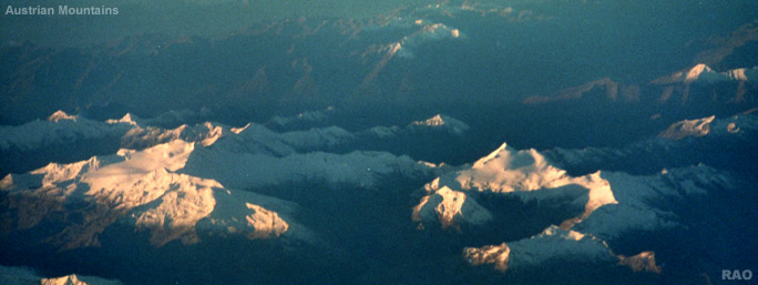
Klimawandel |
|
|
Klimawandel |
|
|
WMO:
2008 AMONG THE TEN WARMEST YEARS; MARKED BY WEATHER EXTREMES AND SECOND-LOWEST
LEVEL OF ARCTIC ICE COVER
|
 |
|
|
 |
|
The
year 2008 is likely to rank as the 10th warmest year on record since the
beginning of the instrumental climate records in 1850, according to data
sources compiled by the World Meteorological Organization (WMO). The global
combined sea-surface and land-surface air temperature for 2008 is currently
estimated at 0.31°C/0.56°F above the 1961-1990 annual average of
14.00°C/57.2°F. The global average temperature in 2008 was slightly
lower than that for the previous years of the 21st century due in particular,
to the moderate to strong La Niña that developed in the latter half
of 2007.
The
Arctic Sea ice extent dropped to its second-lowest level during the melt
season since satellite measurements began in 1979. Climate extremes, including
devastating floods, severe and persistent droughts, snow storms, heatwaves
and cold waves, were recorded in many parts of the world.
This
preliminary information for 2008 is based on climate data from networks
of land-based weather stations, ships and buoys, as well as satellites.
The data are continuously collected and disseminated by the National Meteorological
and Hydrological Services (NMHSs) of WMO�s 188 Members and several collaborating
research institutions. Final updates and figures for 2008 will be published
in March 2009 in the annual WMO Statement on the Status of the Global Climate.
WMO�s
global temperature analysis is based on two complementary sources. One
is the combined dataset maintained by both the Hadley Centre of the UK
Meteorological Office, and the Climatic Research Unit, University of East
Anglia, UK. The other dataset is maintained by the US Department of Commerce�s
National Oceanic and Atmospheric Administration (NOAA).
|
 |
|
| Regionale
Temperatur-Anomalien - Regional temperature anomalies |
|
Western
Siberia and part of the Scandinavian region, recorded a remarkably mild
winter. January and February were very mild over nearly all of Europe.
Monthly mean temperature anomalies for these months exceeded +7°C in
some places in Scandinavia. In most parts of Finland, Norway and Sweden,
winter 2007/08 was the warmest recorded since the beginning of measurements.
In contrast, the boreal winter was remarkably cold for a large part of
Eurasia extending eastward from Turkey to China. Some places in Turkey
had their coldest January nights in nearly 50 years. This extreme cold
weather caused hundreds of casualties in Afghanistan and China.
February
was a cold month across most of the USA Midwest, with average daily temperatures
ranging from 4.0°C to 5.0°C below normal in some areas.
A
very cold episode, due to an early Antarctic air mass outbreak, occurred
in May in southern South America, particularly in central Argentina, where
the minimum temperature dropped below -6°C in some locations, breaking
annual absolute minimum temperature records. Conversely, mean July temperatures
were more than +3°C above average in large parts of Argentina, Paraguay,
southeast Bolivia and southern Brazil, making it the warmest July in the
last 50 years for many locations. Also, November broke historical temperature
records in association with an unusual heatwave. Central Argentina, including
Buenos Aires city, had its warmest November in the last 50 years.
In
March, southern Australia experienced a record heatwave that brought scorching
temperatures across the region. Adelaide experienced its longest running
heatwave on record, with 15 consecutive days of maximum temperatures above
35°C. Also, several heatwaves occurred in south-eastern Europe and
the Middle East during April, associated with a very warm spring observed,
not only in this region but also in a large part of the rest of Europe
and Asia.
nach
oben
| Dürren
- Prolonged drought |
|
At
the end of July, most parts of the Southeast of North America were classified
as having moderate to exceptional drought, based on the US Drought Monitor.
The continuous dry conditions across northern and central California hindered
efforts to contain numerous large wildfires.
Southern
British Columbia in Canada experienced its fifth driest period in 61 years.
In Europe, Portugal and Spain had their worst drought winter in decades.
In
South America, a large part of Argentina, Uruguay and Paraguay experienced
a prolonged and intense drought during most of 2008, which caused severe
damage to agriculture.
Dry
conditions in south-eastern Australia reinforced long-term drought over
much of that region, with Victoria having its ninth-driest year on record.
These conditions exacerbated severe water shortages in the agriculturally
important Murray-Darling Basin, resulting in widespread crop failures in
the area. September and October, in particular, were exceptionally dry
in this region.
nach
oben
| Überschwemmungen
und starke Stürme - Flooding and intense storms |
|
In
January, 1.3 million square kilometres (km2) in 15 provinces in southern
China were covered by snow and experienced persistent low temperature and
icing. This weather affected the daily life of millions of people who suffered
from disruptions of transport, energy supply and power transmission, as
well as damage to agriculture.
In
Canada, several all-time snowfall records were set during winter reaching
more than 550 centimetres (cm) in many locations, including Quebec City.
The accumulation of snow was heavy enough to cause numerous roofs to collapse,
killing at least four people. In Toronto, the 2007/2008 winter was the
third snowiest on record in the 70 year of snow measurement records. At
the end of January, Prince Edward Island was struck by one of the worst
ice storms in decades. Nearly 95 per cent of the province lost power
for a time.
In
the United States of America, heavy April rainfall combined with previously
saturated ground and snowmelt resulted in widespread major flooding that
affected Missouri and southern Indiana. During the month of June, daily
precipitation records were broken in many parts of Iowa, Illinois, Wisconsin
and Missouri. Also, this year was one of the top 10 years for tornado-related
fatalities (123 total) since reliable records began in 1953. According
to statistics, from January to August, 1 489 tornadoes were recorded, marking
a record since 1953.
In
Germany, between May and September, a large number of strong thunderstorms
with heavy rain, tornadoes and hail storms were observed, causing some
casualties and significant damages.
Sub-Saharan
Africa, including West and East Africa, was affected by heavy rains, which
caused the worst-ever recorded flooding in Zimbabwe and affected more than
300 000 people in West Africa during the monsoon season.
In
northern Africa, heavy and extended rainfall during the period of September
to November affected Algeria and Morocco, causing important infrastructure
damage and several casualties in many cities and villages. Extreme rainfall
intensities were recorded in northern provinces of Morocco with up to 200
millimetres (mm) of rainfall in less than six hours. Within the same climate
anomaly context and period, intense rainfall was also recorded in south-western
Europe. In Valencia, Spain, a total rainfall of 390 mm was recorded in
24 hours, of which 144 mm were recorded in less than one hour. In France,
heavy and intense rains affected several locations from 31 October to 2
November. In three days, total rainfall reached 500 mm in some locations,
which caused severe flooding and flash floods particularly in central and
east-central parts of the country.
Several
major rain events affected eastern Australia in January and February, causing
significant flooding, particularly in Queensland. In November, widespread
heavy rains occurred across most of the continent, ending an extremely
dry period in central Australia. Associated severe thunderstorms caused
damage from winds, hail and flash floods in many places.
In
southern Asia, including India, Pakistan and Vietnam, heavy monsoon rains
and torrential downpours produced flash floods, killing more than 2 600
people, and displacing 10 million people in India.
In
western Colombia, continuous above-normal rainfall resulted in severe flooding
that affected at least half a million people and caused extensive damage
and landslides during the second half of the year.
 Monsunniederschläge Monsunniederschläge
nach
oben
| Entwicklung
von La Niña |
|
The
first quarter of 2008 was characterized by a La Niña event of moderate
to strong intensity, which began in the third quarter of 2007 and prevailed
through May 2008. The large area of cool surface waters over the bulk of
the central and eastern equatorial Pacific, combined with warmer-than-normal
conditions in the equatorial western Pacific, represented typical La Niña
forcing on the global atmosphere; many climate patterns reflected those
normally observed during a La Niña event, both in the vicinity of,
and remote from, the tropical Pacific. La Niña conditions have gradually
weakened from their peak strength in February, and near-neutral conditions
prevailed during the later half of 2008.
La
Niña
nach
oben
| Ozon |
|
The
ozone hole area reached a maximum of 27 million km2 on 12 September. This
is less than in the record year 2006 (more than 29 million km2) but larger
than in 2007 (25 million km2). The variation in the size of the ozone hole
from one year to another can be, to a large extent, explained by the meteorological
conditions in the stratosphere.
Ozonloch
Antarktis
Stratosphäre
Klimawandel
in der Antarktis
nach
oben
| Tropische
Wirbelstürme |
|
The
most deadly tropical cyclone recorded in 2008 was Cyclone Nargis, which
developed in the North Indian Ocean and hit Myanmar in early May, killing
nearly 78 000 people and destroying thousands of homes. Nargis was the
most devastating cyclone to hit Asia since 1991 and resulted in the worst
natural disaster on record for Myanmar.
A
total of 16 named tropical storms formed in the Atlantic including eight
hurricanes, five of which were major hurricanes at Category 3 or higher
(averages are eleven, six and two, respectively). The 2008 Atlantic hurricane
season was devastating, with many casualties and widespread destruction
in the Caribbean, Central America and the United States of America. For
the first time on record, six consecutive tropical cyclones (Dolly, Edouard,
Fay, Gustav, Hanna and Ike) made landfall on the United States of America,
and a record three major hurricanes (Gustav, Ike and Paloma) hit Cuba.
Hanna, Ike and Gustav were the deadliest hurricanes during the season,
causing several hundred of casualties in the Caribbean, including 500 deaths
in Haiti.
In
the East Pacific, 17 named tropical storms were recorded, of which seven
evolved into hurricanes and 2 of them into major hurricanes (averages are
sixteen, nine and four, respectively).
In
the western North Pacific, 22 named tropical storms were recorded, and
10 of them were classified as typhoons compared to the long-term average
of 27 and 14, respectively. Philippines, Cambodia, Laos, Thailand, Vietnam
and south-eastern China were the most affected by these events. For the
first time since 2001, no named tropical cyclones made landfall in Japan
this year.
tropische
Wirbelstürme
nach
oben
| Arktisches
Meereis - Artic sea ice |
|
Arctic
sea ice extent during the 2008 melt season dropped to its second-lowest
level since satellite measurements began in 1979, reaching the lowest point
in its annual cycle of melt and growth on 14 September 2008. Average sea
ice extent over the month of September, a standard measure in the scientific
study of Arctic sea ice, was 4.67 million km2. The record monthly low,
set in 2007, was 4.3 million km2.
Because
ice was thinner in 2008, overall ice volume was less than that in any other
year.
A
remarkable occurrence in 2008 was the dramatic disappearance of nearly
one-quarter of the massive ancient ice shelves on Ellesmere Island. Ice
70 metres thick, which a century ago covered 9 000 km2, has been chiselled
down to just 1 000 km2 today, underscoring the rapidity of changes taking
place in the Arctic. The season strongly reinforces the 30-year downward
trend in Artic sea ice extent.
Klimawandel
in der Arktis
Nordwest-Passage
| Source:
World Meteorological Organization WMO, December 2008 |
|
nach
oben
|
Weitere
Informationen
|
|
nach
oben
|
Links
|
|
 |
|
Externe
Links |
|